LiDAR FOR RAILWAYS

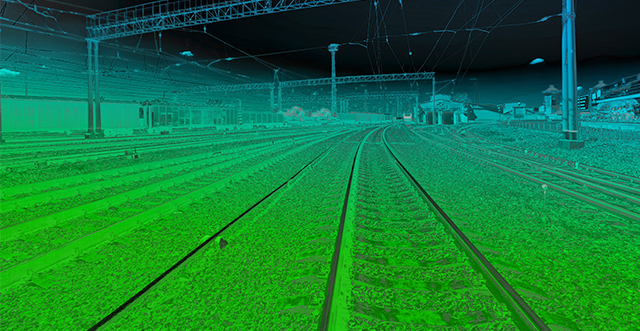
HC Robotics empowers railway companies with cutting-edge LiDAR technology to transform operations. Our high-precision 3D mapping solutions create a comprehensive digital picture of tracks, infrastructure, and the surrounding environment. This data empowers safety enhancement, maintenance optimization and operational efficiency.

Key Applications:

  • Railway infrastructure monitoring through comprehensive assessments of tracks, bridges, tunnels, and overhead lines
  • Precision vegetation management through detailed vegetation mapping along railway corridors
  • Streamlined route planning and expansion through accurate terrain mapping with high-resolution elevation models, terrain profiles, and cross-sectional views, aiding in route selection, gradient analysis, and earthwork volume calculations
  • Operational efficiency gains of Railways through streamlined asset management and route planning